Looking for map skills activities for kids?
The best part about teaching map skills is that generally most kids are super intrigued with the topic!
They’re skills that they see adults using and talking about. It gives the kids an opportunity to discuss places they’ve only heard of, but have no idea where they actually are. 🙂
And your students will know that using map skills is typically something we always do in our daily lives, so it’s important to master them!
Getting them on board with the topic isn’t hard, but getting them to understand and use the map skills they learn is a bit of a different task.
Thankfully, though, I’ve compiled some of my favorite map skills activities that are simple, fun, and effective!
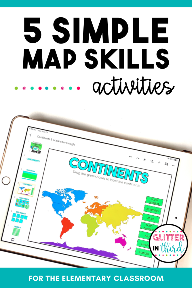
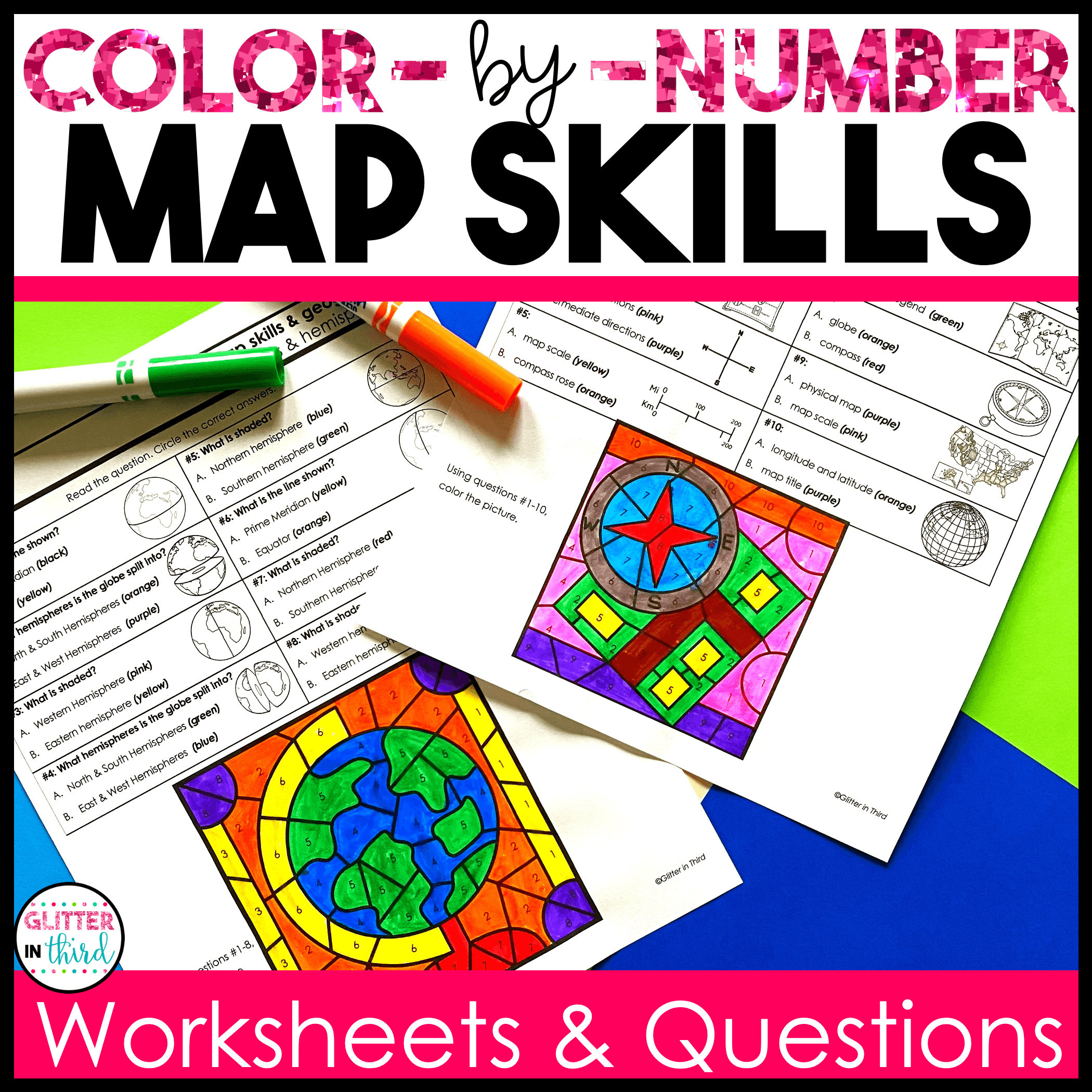
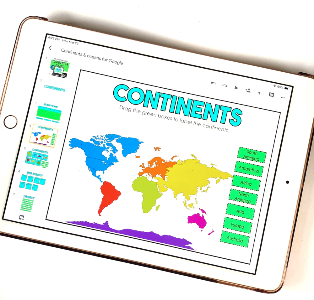
This bundle comes with 3 different resources focusing on map skills and how to read maps, continents and oceans, and the equator, prime meridian, and hemispheres.
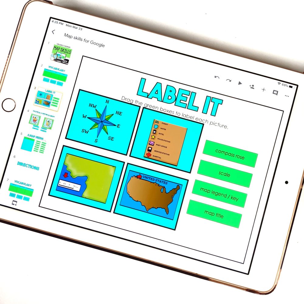
Each resource comes with multiple different activities involving drag-&-drop, short answer, and even opportunities for students to search the web for facts about certain topics!
There is a specific website that’s given for this activity, as well as an answer key for each lesson, so no need to search for the research content or answers yourself.
Keepin’ it simple! 🙂
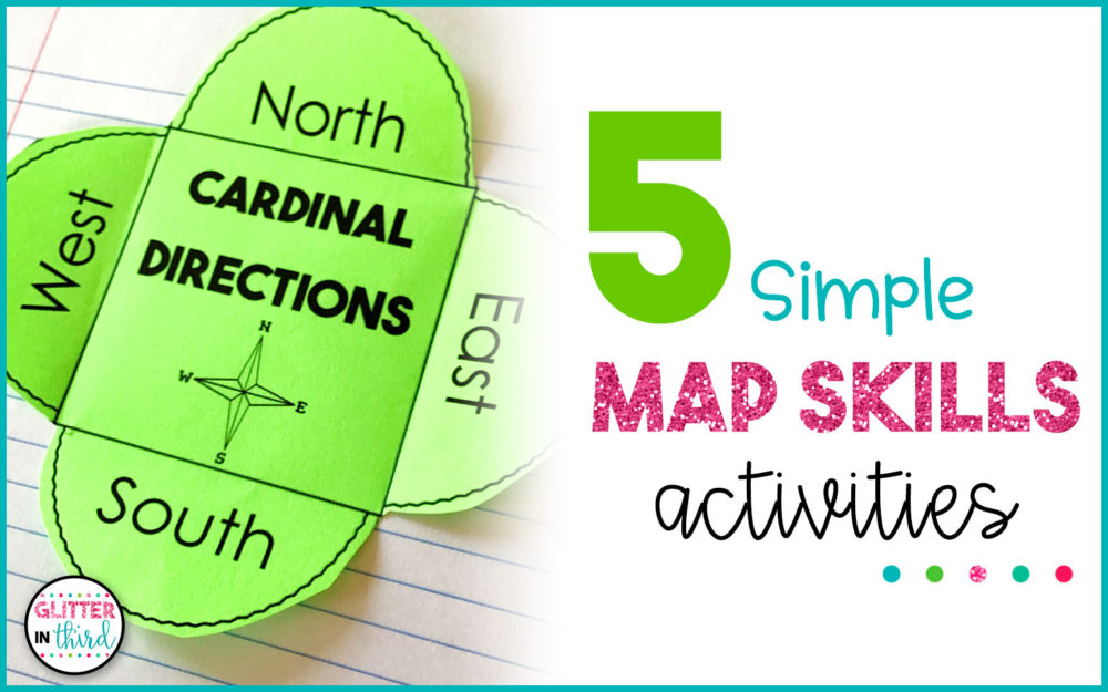
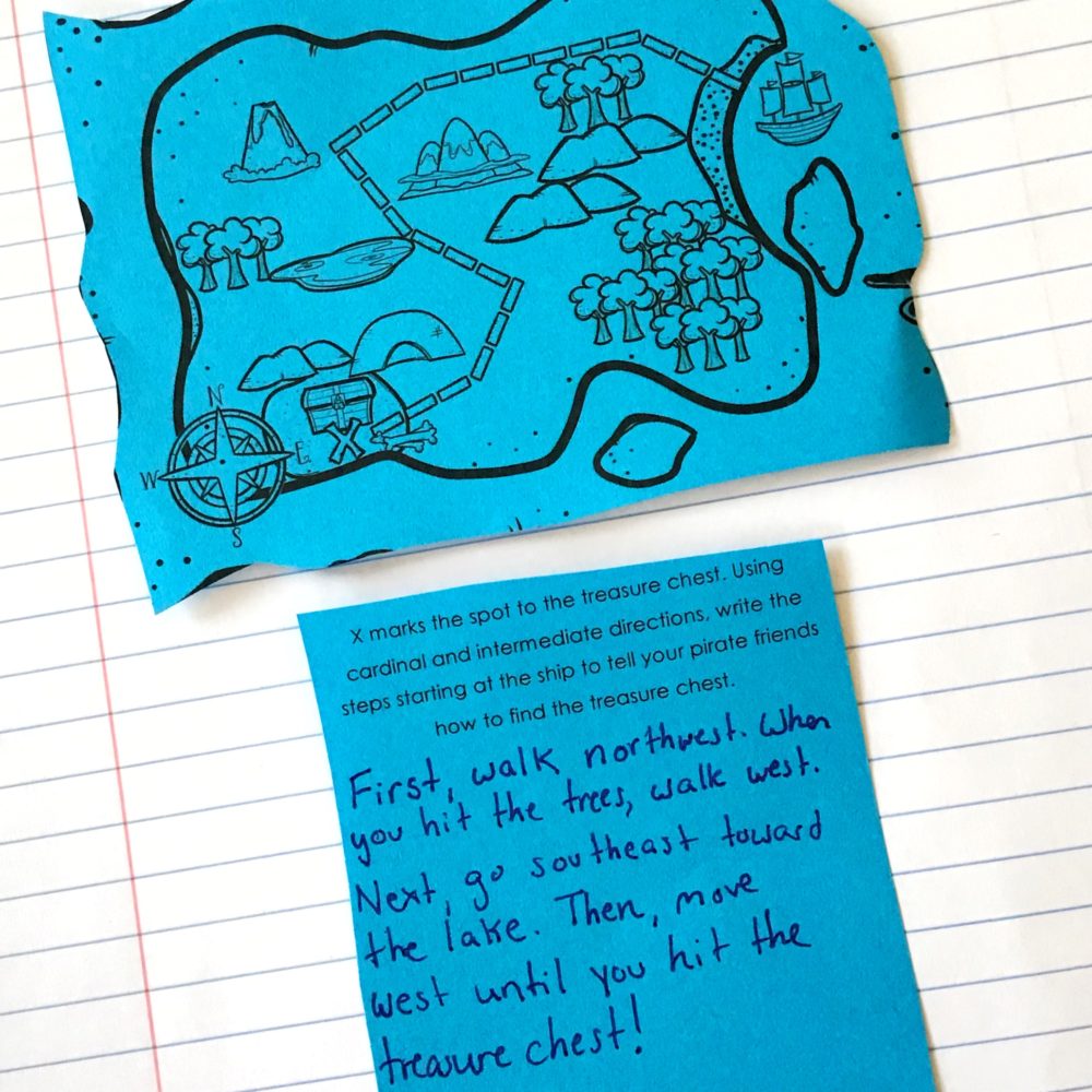
The map skills resource focuses on key vocabulary, identifying cardinal and intermediate directions on a compass, reviewing physical and political maps, as well as working with map legends, keys, symbols, and understanding scales.
Your students will learn how to label the 4 hemispheres, prime meridian, and equator on a map and globe. And will have lots of opportunities to research the continents and oceans by finding specific facts about them, their size, and identifying which one is which just by looking at the shape!
Super impressive! Sometimes I struggle with doing that, even just with our United States! 😉
You can read more about each individual product in this map skills activity bundle by clicking here!
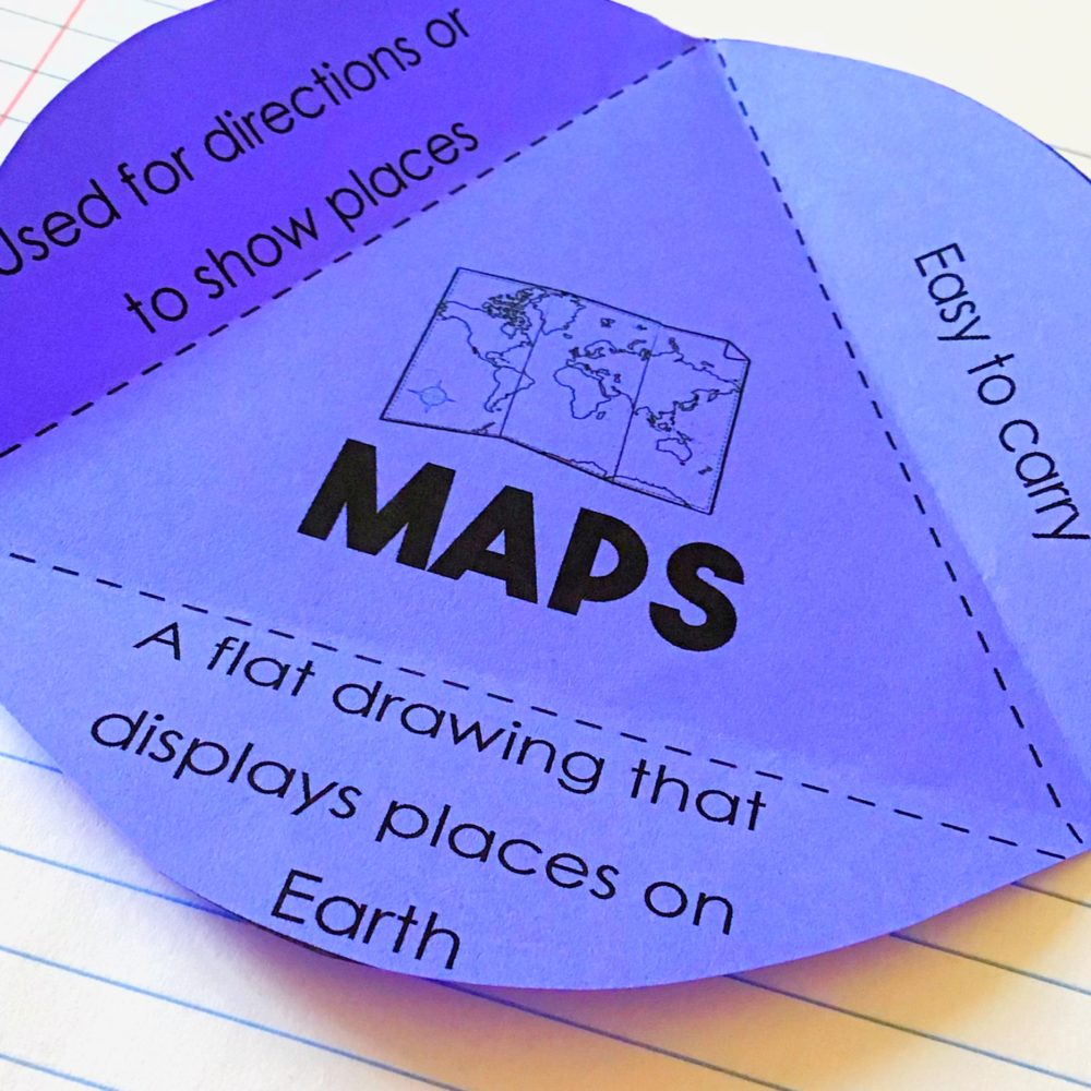
Although I’m always a fan of a good interactive notebook made from paper, you can convert each one of these into a digital interactive version so your students can complete them online!
There are a total of 25 different activities among the 3 notebooks and is perfect for supplementing with the Google Classroom resource! These are the perfect map skills activities for kids.
The same topics are focused on in each different notebook – Map skills, equator and prime meridian, and continents and oceans.
I have found sometimes it’s simpler for students to use paper to label geographic areas and read maps.
And although our world is turning more and more digital by the day, when you’re just starting out with the basics, looking at a paper map or resource can be helpful to students!
Feel free to learn more about each notebook in this bundle by going here!
As you’re just beginning your map skills unit, one of the simplest ways you can get your student’s understanding and using cardinal and intermediate directions is by introducing them in your actual classroom.
Beforehand, take a photo of your school building and show it to your class.
You can then discuss where your classroom is located in the school – east, west, north, or south side, or even more of an intermediate direction!
You can also practice having your students move to the different directions in the room.
Simplify things by labeling each of the directions on your walls, so it’s easier for them to remember at first. 🙂
After they have a good understanding, get on Google Earth and look at the rest of your community!
Where are certain restaurants, parks, or businesses located in relation to the school?
Having your students actually make statements such as, “The park is west of the elementary school,” or, “The bakery is northeast of the gas station,” will help them realize how directions are used, why they’re important, and will help them as you expand outward to discussing cities, states, countries, and continents.
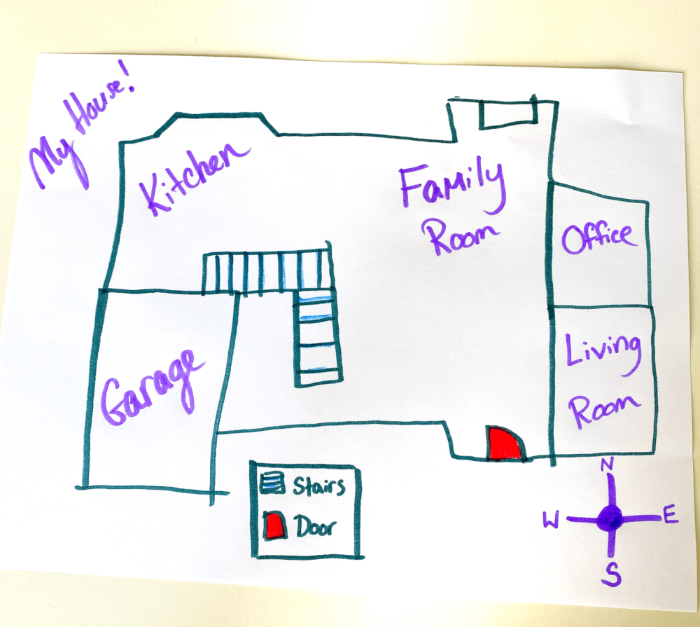
Another fun activity to get your students more familiar with reading maps is to have them create their own map of their home. This will probably take some modeling on your part, beforehand. 🙂
Have each student make a sketch of the inside of their homes, so that when you look at the map you can see every room in the house.
You can require them to use a legend, symbols (they can create their own), and give each student the opportunity to present their maps to the rest of the class while using statements that involve the directions.
Or, you can have your students create basic questions for their peers to answer about their maps. Questions such as, “Which direction is the living room located in the house?” or, “Which room is in the northeast corner of the house?”
I would suggest having them use a compass rose directly on the paper so they are answering the questions based upon the map they drew, and not in relation to how it physically sits in the city!
For example, the way a house sits based upon the actual address may show that the living room is on the south side of the house, when really it doesn’t show that on the map that’s been drawn.
If this project ends up going home at all, that may confuse your students’ parents! 😉
Be sure to specify directions before beginning the project!
I encourage you to go as far as technology allows you with this activity! 🙂
One of the best ways to set up a mystery zoom call with another classroom across the country, or if you get lucky, across the world, is by reaching out to other teachers via Twitter!
There are so many amazing education accounts out there. Here are a few of my favorites:
I also recommend following any of your state departments of education!
You can tweet any of these accounts directly, asking if anyone would be willing to host a mystery zoom call with you.
There are always teachers watching for threads like these to collaborate!
The idea behind the mystery zoom call is give the other class hints as to where you are located.
Here are a few ideas – Obviously tweak the clues to have them apply to your location! 🙂
You could even get as specific as giving your longitude and latitude coordinates! I would recommend starting with your more generic clues to give the other class a general idea of your vicinity, and then move to more specific statements.
Your students will have so much fun working together to “guess” the other class’s location, and it’s a fun way to meet new friends. 🙂
Be sure to check with your building administrator to get approval before hosting a mystery zoom call.
I always believe when it comes to working on map skills activities for kids, simple is better.
The more you can relate these skills to real-life experiences, and get your students interested in the world around them, the more they and you will have!
Looking for more map skills ideas? Make sure to check out my old blog post on the topic here!